Where was the Garden of Eden where the first people lived? About the geographical location of paradise, biblical archaeology, the reliability of finds and hypotheses, as well as the path to the lost paradise - Archpriest Alexander Nemchinov, head of catechesis courses in the Dnepropetrovsk diocese, cleric of the Church of the Nativity of the Blessed Virgin Mary.
Lucas Cranach the Elder - Paradise
The only thing that is reliably known from the Holy Scriptures about the earthly location of paradise is that “the Lord God planted paradise in Eden in the East” (Genesis 2:8). It is also said about the river for irrigating paradise, which was divided into four rivers: Pison, flowing around the land of Havilah, rich in gold, bdellium and onyx, Gihon, flowing around the land of Cush, Hiddekel (Tigris), flowing in front of Assyria, and the Euphrates. And if the geography of the Tigris and Euphrates is well known to us, then the rivers Pison and Gehon are still the subject of debate. Despite numerous versions, the land of Havilah and “bdellah” also remain unknown. The question of the geography of paradise, like everything unknown, arouses interest among both church and secular researchers. The patristic teaching considers not so much the geographical location of heaven as the spiritual state of heavenly bliss, lost after the Fall: “The kingdom of God is within you” (Luke 17:21). However, it is possible that for many people with a stable atheistic worldview, biblical archeology and, in particular, “heavenly geography” will serve as a kind of beginning of the tangibility of biblical history, will help to understand that the Bible is not a “mythological collection”, but a Book in which the visible , a reality understandable to everyone and the Supreme, transcendental Reality. Thus, the historical reliability of the Bible for someone can become the beginning of the knowledge of God.
In complete harmony of creation and Creator
Garden of Eden. Vatican Code. 12th century
The entire universe contains numerous evidence of the Divinity of its origin. The most important of them is tripartiteness (trichotomy), reflecting the Trinity of the Persons of the Divine. This tripartiteness is manifested throughout the Universe, in all living and inanimate nature, in anthropology and, of course, in the trichotomy of the order established by God on earth. In the laconic and pithy narrative of the book of Genesis it is said that “the Lord God planted a garden in Eden in the east; and he placed there the man whom he had created” (Gen. 2:8). Subsequently, the words “We are going” and “paradise” became almost identical. But in the primary, biblical meaning, Eden is the name of the area, and paradise is the wondrous Divine Garden in the east of Eden, in which the Lord placed the first people. In this Garden of Eden, our first parents communicated with God directly and were in complete harmony between creation and the Creator - in heavenly bliss. There is a stable theological point of view, according to which in such a world order a three-part structure is also recognized: paradise, Eden and the rest of the world. Later, almost three millennia later, in the structure of the Jerusalem Temple, paradise became a prototype of the Holy of Holies, Eden - the sanctuary, and the world outside Eden - the courtyard. This same three-part structure is preserved in the structure of our New Testament Orthodox church: paradise - the altar, Eden - the meal (the central part of the temple, where the worshipers gather) and the vestibule, symbolizing the outside world.
Where was heaven on earth?
The question of the location of the earthly paradise, which served as the residence of the first human couple before the Fall, is one of the most difficult questions of biblical geography. The history of this issue is remarkable both for the significant number of scientific forces that took part in solving the problem, and for the extraordinary variety of results achieved by researchers. This diversity is most closely explained by the ambiguity - given the current state of accurate information on the geography of the ancient world - of some geographical indications made in the text of the biblical narrative about the earthly paradise. It is necessary to write out this narrative in order to see more clearly at which points it is unclear and could more or less hamper interpreters.
Genesis 2:8–15 reads: And the Lord God planted a garden in Eden
(lit. from Hebrew in Eden)
in the east;
and he placed there the man whom he had created. And the Lord God made from the ground every tree that is pleasant to the sight and good for food, the tree of life in the midst of the garden, and the tree of the knowledge of good and evil.
From Eden
(Heb. Eden)
a river came out to water paradise;
and then (literally from Hebrew and from there)
it was divided into four rivers:
The name of one is Pishon
(Heb. Pichon):
it flows around the whole land of Havilah, where there is gold;
And the gold of that land is good, there is bdellium and onyx stone
(Heb. hashshogam).
The name of the second river is Gihon
(Geon):
It flows around the entire land of Kush.
The name of the third river is Khiddekel
(Tiger):
it flows before Assyria.
The fourth river is the Euphrates. And the Lord God took the man
(whom he created)
and put him in the garden of Eden to cultivate it and keep it.
Of the rivers which, according to this narrative, flowed from paradise, forming divisions of one current, the most famous and not subject to doubt as to its location is the “fourth river Euphrates,” the western of the two great rivers between which Mesopotamia lies. Regarding the third river, confusion might arise only about its name in Hebrew. text named Khiddekel. But, on the one hand ,
there is also obvious that Assyrian.
Idiclat
is a form that, however, appears only once in hitherto known monuments of Babylonian-Assyrian cuneiform writing, but leaves no doubt that it refers to the same river, which is much more often called the abbreviated
Diclat;
the latter name from the ancient Babylonians and Assyrians passed into the later Chaldean dialect:
Diglat,
into the Syriac language:
Deklat,
into Arabic:
Dijlat.
On the other hand, in ancient Persian the same river was called
the Tigris
(in Bundegesh -
Dagrad),
from which name, obviously, came from the Greek.
Τίγρης or Τίγρις (p. 170 et seq.). To establish the identity of Τίγρις and Diklat-Diglat, it is only necessary to add that the letters “r” and “l” are sometimes replaced by one another in both Aryan and Semitic languages: cf. Greek σιγηρὸς=σιγηλὸς, κρίβανος=κλίβανος; euro
(
Isa
.
13:22 )
. _
_
The greatest difficulties were caused to the interpreters by the other two rivers Pichon and Gihon, in connection with the geographical indications with which the priest. The writer apparently wanted to more accurately determine the location of the flow of these rivers. There are no rivers with such names in Mesopotamia now; and in the monuments of ancient history, until very recently, there were no open indications of rivers whose names or other signs would allow their identification with Pichon and Gihon. Meanwhile, within the meaning of the biblical narrative about the earthly paradise, Pichon and Gihon were branches of the same river, the other two divisions of which were the Tigris and Euphrates. Therefore, on the one hand, a variety of comparisons of the names “Pichon” and “Gihon” were tried with various geographical names, more or less similar to them - paradise was believed either in southern Babylonia at the mouths of the Tigris and Euphrates rivers, or in Armenia, or in the vast space, which would include, on the one hand, ancient Egypt, on the other - part of the East Indies with the Indus or Ganges rivers - they believed even in present-day Russia or Prussia, on the other hand, so as not to place the areas of the Tigris and Euphrates rivers outside boundaries of paradise and in order to establish the connection of these Mesopotamian rivers with other supposed, currently more or less distant from the Tigris and Euphrates, paradise rivers, it was believed that in the space of the primitive paradise after the fall of people, the earth’s surface suffered changes that made the place of paradise unrecognizable1.
Professor Friedrich Delitzsch addresses the question on the basis of data discovered through the study of Assyrian-Babylonian cuneiform monuments. Partly in the lists of rivers and canals of Mesopotamia, partly in historical monuments of wedge-shaped writing, preserved in the ruins of various cities of ancient Babylonia and Assyria, indications were found of two water streams, the names of which are remarkable for their similarity with the names: Pichon and Gihon.
1) An indication of the first of them cannot be called direct and immediate. The word that the Assyrians pronounce in writing,
borrowed by them from the ancient inhabitants of southern Mesopotamia, for whom
pi-sa-an-na
meant the same as among the Assyrians
nazabu
or
natsabu.
The meaning of the word “pisanu” seems quite clear from the fact that in one of those lists of synonyms, of which many were discovered on the ruins of Babylonian and Assyrian cities and published in vols.
ratu
(Heb.
רַתַט
is used as a synonym for this “writing” = a bed or bed along which water, aqueduct, canal flows.
To the word “natsabu (nazabu”) the addition is made: sa itsi
(made of wood) or:
sa kanu
(made of reed).
From these comparisons it seems quite clear that natsabu=nazabu=pisanu generally meant a container for water. But writing
is, therefore, a common noun (p. 77 et seq. 142).
The use of the same word in the sense of the proper name of a canal or river has not yet been noticed in the monuments of cuneiform writing. But it seems remarkable the consonance of the Assyrian palgu
(=
פֶלֶג
channel), a synonym for the already mentioned
ratu,
and, therefore,
pisan,
with the name of one of the most important and significant canals in terms of length, depth and width of ancient Mesopotamia, namely the name
Pallakopas.
The last name is given by Arrian to the large shipping canal that emerged from the Euphrates near Babylon and flowed parallel to this river on its right side all the way to the Persian Gulf, into which it flowed at a distance of almost a whole geographical degree from the mouth of the Euphrates, closer to the Indian Ocean. Professor Friedrich Delitzsch, following the example of Arrian, calls Pallacopas a canal, i.e. an artificially constructed bed to drain the waters of the Euphrates directly into the sea and to prevent the disastrous consequences of the spring flood of the Euphrates. However, if Pallacopas is an artificial structure made by human hands, then can it be identified with Pichon, which the sacred writer of everyday life seems to be one of the rivers flowing from paradise already at the time when the first human couple lived there? The answer to this question can be the following comments from Professor Friedrich Delitzsch himself and the famous geographer, Prof. K. Ritter. “Both rivers, the Tigris and the Euphrates,” says Delitzsch, “have changed their course many times since ancient times, partly by themselves, partly as a result of the work of human hands, and numerous canals, most of them long dried up and covered with sand, can only with difficulty, and sometimes completely cannot be distinguished or determined by their original length and direction." Many of these canals “may have once been branches of the Euphrates.” Ritter’s opinion about Arrian’s so-called Pallacopas canal is especially important. “It is very likely that the extraordinary, so large and navigable Pallacopas in former times was even the bed of the Euphrates, now abandoned by the river, which constantly tended to move from west to east. Like other wandering rivers, the Nile, Ganges, Indus, Goango, here too the previously partially dried river branches with their depressions, covered with mud and covered with sand for centuries, at times, thanks to connecting channels, with the assistance of human hands, could turn into animated water paths; This is how Pallakopas has been presented since ancient times, as the most direct route along which even under Nebuchadnezzar, the first builder of Teredon, the Euphrates headed to this harbor” (p. 67 et seq.)2. Thus, the possibility opens up that Pallacopas (= Pichon) can be considered one of the many streams through which the waters of the Euphrates poured into the sea - not an artificial canal!..
According to Gen. 2:11, the river Pishon flowed around the entire land of Havilah. There have still been different opinions regarding the geographical meaning of the last name. Since in the genealogical lists of the book of Genesis proper names have as much an ethnographic as a geographical meaning, and since Havilah in the book of Genesis appears to be the son of Cush, the brother of Mizraim (10:7), i.e. Egypt, then the son of Joktan, the son of Eber (v. 29), then they believed that Havilah, as a geographical term, is the name of a partly African country south of Egypt, i.e. Nubia, partly South Arabian, partly Syrian-steppe region. Professor Friedrich Delitzsch sees a trace of the biblical name Havilah in the name Ard el-halat
(=sandy land)3, currently belonging to part of the western edge of the Syrian-Arab desert opposite Egypt.
He suggests that once the name “Havilah” was borne by this entire desert, mainly the eastern-northeastern part of it. If we understand the name Havilah in this latter limited sense, then the branch of the Euphrates, called Pishon-Pallakopas, actually flowed around the entire land of Havilah. The products of the country of Havilah are: high quality gold, bdellium and shogham stone. There is no mention of the country of Havilah in the cuneiform monuments; but it is said about King Merodach-Baladan that this “king of the sea”, i.e. southern Mesopotamia4, presented the Assyrian king Feglaothelassar, among other things, with a lot of gold (Schrader, Keilinschriften und das A. Testament S. 129 et seq.). Bdellium
is usually identified with bdellium, which Pliny calls “an ebony tree, very oily, with leaves like oaks and fruits like figs,” and says that it is found in Arabia, India, Media and Babylonia.
Finally,
Delich identifies
shogam sagima
) stone, which in Assyrian wedge-shaped inscriptions is mentioned among the precious stones with which the Babylonian king decorated himself, just like shogam, so-called among the Jews, was used to decorate high priestly clothing ( Exodus 28:20; 39:13) (pp. 57–61),
2) The name of the second river is Gihon
found by Delitzsch in the Assyrian-Babylonian list of rivers, printed in volume II. The cuneiform inscriptions, fol.
50, column 3. Here, immediately after the names of the Tigris and Euphrates, in line 9, it reads: Gu-ha-an-de,
and translated into Assyrian -
Arakhtum.
A variant was found for this reading:
Gu-ha-an-na, -
without
de,
which, therefore, did not constitute an essential part of the word.
The river Arakhtum or Arakhtu is mentioned more than once in historical monuments of cuneiform writing. Sancherib (also known from the Bible, called Sennacherib in the Greek-Slavic translation) says in one of his inscriptions that he destroyed the wall and rampart along with the temples of Babylon and threw them into the Arachta River. From this it is clear that Babylon stood on the bank of this river Arakhtu, that this river flowed on the left side of the Euphrates, since on the left bank of the Euphrates there were Babylon, the wall, and the temple. In the same volume II. The cuneiform inscriptions on l. 51, in line 27, this river Arakhtu is characterized by the words: “which brings life to Babylon.” From this we can conclude about its significance and importance for Babylon. In Vol. III. The cuneiform inscriptions, on fol. 12, the inscription of Sancherib is printed, in which it is said that this king, having built ships in Nineveh, put the Tyrians, Synodians and Greeks on them, who went down the Tigris to the city of Opis.
Here the ships were pulled onto land and dragged overland to the Arakhtu River.
Launched into this river, the ships (apparently in Babylon) took over the troops, with whom they went down the Arachtus and Euphrates to the Persian Gulf (pp. 73–76). The further fate of this river can be judged from the following data: even during the Arab conquests, a branch of the Euphrates was separated from Babylon, which was then divided into two parts; of them, one headed to the left, into the Tigris River, and the other, bending slightly, flowed again into the Euphrates, into which it flowed a little above the Shatt-el-hai River, connecting the Tigris with the Euphrates. It is remarkable that this sleeve was called Shatt en-Nil.
"Shatt" means: big river. This name excludes the assumption that it was originally an artificial canal. Why it was called the Nile is difficult to say with certainty. Perhaps its size resembled the Nile; Perhaps this name was given to it in memory of some important event in the history of Egypt’s relations with Mesopotamia (pp. 70 et seq.).
The second river, Gihon, appears to flow around the entire land of Cush.
The last name according to Genesis.
10:7 belonged to the eldest son of Ham and the brother of Mizraim; in this comparison, it is generally accepted to mean Ethiopia, the country south of Egypt. The same meaning belongs to this name in other numerous cases when it is found next to either the same Mizraim, or with the names: Luvim (= Libyans, Libya, a country to the west of Egypt) and Lud or Ludim (= according to Josephus - Lydians , North African people, cf. Gen. 10:13): 2 Chron. 12:13; 16:8; Ps. 67:32; Is. 20:3; 43:3; 45:14; Jer. 46:9; Ezek. 29:10; 30:4, 5. But if the Gihon is one of the Mesopotamian rivers, then it could not flow around the land that was in Africa. It seems remarkable that in the book of Genesis 10:7 the sons of Cush are called the ancestors of the tribes not of Africa, but of Asia, namely the tribes that lived in the Syrian-Arab steppe between Palestine and Babylonia. To determine the meaning of the name “Kush”, which is in connection with the name of the Mesopotamian river, it is especially important that, according to Gen. 10:10, the son of Cush, Nimrod, began to reign in Babylon5, Erech6, Akkad7 and Kalne8, in the land of Shinar9, i.e. in southern Mesopotamia. Based on the monuments of the Babylonian-Assyrian cuneiform script, it is now known that the beginning of state and cultural life in southern Mesopotamia was laid by the people who are now commonly called Sumerian-Akkadian, who were related to the Elamite people who lived along the eastern bank of the lower reaches of the Tigris and along the northeastern bank Persian Gulf. The Elamite-Sumerian-Akkadian tribe was the Kush, whose border in Genesis. 2:13 The Gihon River appears. It is remarkable that Herodotus also calls Elam - Κισσίη. and the Elamites - Κίσσιοι. The name of the mountain tribe found in other Greek writers, living north of Susiana (=Elam) towards Media and Assyria, the name Κοσσαῖοι or Κουσσαῖοι, probably indicates the kinship of this tribe with Elam. In the Babylonian-Assyrian cuneiform monuments, the founders of southern Mesopotamian culture and state life are also called Kashshu. And the mountain tribe on the border between Elam, on the one hand, and Assyria and Media, on the other, is also called Kashshi by the Assyrians.
If Kush is the same as Kashsha, then it seems possible to identify Gihon with Guhan, the Mesopotamian branch of the Euphrates (pp. 51–55).
But, according to the legend of Gen. 2:10, all four rivers, not only the Euphrates, Pichon and Gihon, but also the Tigris, formed branches of one river. Meanwhile, just as at present the Tigris and Euphrates do not seem to be two branches of one stream, to which Pichon and Gihon could be placed in the same relation, according to the Bible, so the monuments of wedge-shaped writing do not give reason to think that about the place where Pishon and Gihon separated from the Euphrates, the Tigris once flowed along the same channel as the Euphrates. In view of this difficulty, Friedrich Delitzsch draws attention to the result of trigonometric measurements of the terrain along which the Tigris and Euphrates rivers flow - measurements taken and carried out by the Prague scientist, Augustin Hausdorff. Based on these measurements, Hausdorff came to the conclusion that the Tigris and Euphrates must have joined north of Baghdad in prehistoric times, precisely at 62° east. longitude and 34° north. latitude, therefore, approximately near the city of Opis. It is remarkable that even now in this place the Tigris and Euphrates are approaching one another, while further to the south the Tigris is again moving away from the Euphrates. Due to the gradual accumulation of silty sediment in the Euphrates, the area through which the latter flows has risen over time above sea level more than the area through which the Tigris flows. The left bank of the Euphrates became four meters higher than the right bank of the Tigris (pp. 82. 83). Delitzsch, however, finds it more than questionable that the biblical narrative should refer to this amazing phenomenon of prehistoric times; but he admits, at the same time, that “to others this circumstance may seem more important” in the question of the location of the earthly paradise. And in fact, it seems remarkable even at first glance at the map of Mesopotamia that all the channels connecting the Euphrates with the Tigris, near Akkad-Sippar and Ctesiphon, head from the Euphrates to the east and flow into the Tigris, which is thus, as it were, fed by the waters of the Euphrates. And Delitzsch himself says: “While the rest of Babylonia is irrigated as much by the Euphrates as by the Tigris, this northern part is fertilized exclusively by the Euphrates; The bed of the Tigris is, as it were, only the eastern border of the Euphrates, which sends its waters to the Tigris through many canals, ditches and gullies. Already classical writers drew attention to this interesting hydrographic feature: thus Arrian reports that of the two large Mesopotamian rivers, the Tigris occupies a lower place than the Euphrates, which is why the branches or channels of the Euphrates carry their waters in large quantities to the Tigris. And Rennel10 notes that the Euphrates, upon entering the plain of Babylonia, flows at a higher level than the Tigris... while further, below the ruins of Babylon, the Euphrates loses this high level of its waters” (p. 67).
The place where the first human couple lived before the Fall, in Gen. 2:15; 3:23, 24; Joel. 2:3; Ezek. 36:35, called the garden of Eden, gan Eden,
in Gen.
2:8, 10 The country in which this garden was planted was named: Eden
, a name that is sometimes used to designate the garden.
Friedrich Delitzsch in the monuments of wedge-shaped writing finds partly an idea, partly a name, which is close to the biblical name gan-eden,
and the concept associated with it in the Old Testament, and his judgments assimilate the meaning of only guesswork.
The name of paradise, as is known, is translated by 70 interpreters with the words: παράδεισος τῆς τροφῆς = glory. "paradise of sweets" The area in which Pallakopas (=Pichon) and Gihon separated from the Euphrates, in which the Tigris comes closest to the Euphrates, is called Kardunias in the monuments of the wedge-shaped script. The so-called area belonged to Akkad, i.e. northern or northwestern Babylonia, as part to the whole; the most important city in it was Babylon. Xenophon, Strabo, Ammianus Marcellinus wrote about this part of Mesopotamia, expressing surprise at the wealth of its irrigation, at the multitude of its canals, bridges, vineyards, fruit fields, date forests, at all kinds of cultivation. Even today, that country is replete with palm forests. The remark of the Babylonian Talmud about the Babylonian palm trees that they “go back to the first man” (pp. 64 et seq.) is no stranger to significance. The Babylonian name of this area: Kar-Dunias
originates from the Sumerian-Akkadians, in whose language
Dunias
was the name of some god (since this word is sometimes preceded, even when it is combined with
kar,
the determinative
an
= ilu = god), and
kar
meant the same as Assyrian.
Semitic padana, eklu
or
ginu,
i.e.
field, planting, garden. It is remarkable that in the monuments of the wedge-shaped script the name of this area is sometimes pronounced: Gindun
(=garden of the god Dong).
The meaning of the word kar
in the Sumerian-Assyrian dictionary is expressed by the Assyrian verb eteru = protect, protect, spare - hence
kar
in the sense of a noun would mean: “wall, enclosed place.”
The Hebrew word גן
has a similar meaning, from the verb
גָנַן
to protect.
“Garden of the god Dun” (the last two syllables in the word “Dunias” - ias,
according to Friedrich Delitzsch, mean: “countries, lands”) - these words would resemble the Bible.
name: “garden of the Lord” (Gen. 13:10), which obviously means the same as the garden planted by the Lord (cf. Gen. 2:8 et seq.). Here it is also appropriate to recall the meaning of the Sumerian name of the city of Babylon: Tintira
= grove, garden of life, immortality;
such a meaning of the name would be reminiscent of the biblical “tree of life” (Gen. 2:9; Prov. 3:18; 11:30; 13:12; 15:4). If in this way the name Gan-Eden
can be equated with the name
Kardunias = Gindun,
then the monuments of cuneiform writing provide data for determining the location and country of Eden.
In one Sumerian-Assyrian dictionary, the Babylonian-Semitic word tseru
(field, plain, desert, actually lowland, depression) is put in correspondence with the non-Semitic word
edin,
which, however, judging by the same dictionary, was also used in the Semitic Assyrian language in the form
Edinu.
In other monuments of cuneiform writing,
Tsabé Edini
= people (inhabitants) of the steppe, nomadic tribes inhabiting the country of Gute or Sute (east of the Tigris, opposite Babylon) rich in pastures are repeatedly mentioned.
And it is remarkable that, according to Wetzstein’s research, both river valleys of the Euphrates and Tigris from the junction of these rivers at Shat al-Arab in the south to approximately 36º at the Euphrates and up to 35º at the Tigris to the north - these valleys are called zor
(=deepening) , is a name that attracts attention due to its similarity to
tseru -
the Babylonian-Semitic equivalent of the Sumerian
edin.
At the same time, Wetzstein's assumption that the name mentioned in Dan.
3:1 the fields of Deira (Δεεφὰ), דּוּרָאבִקְעַת
there is only a Chaldean modification of the original
הַזּוֹר בִקְעַת
– the valley of Zor (pp. 79. 80)11
Book by Prof. Friedrich Delitzsch's work consists of no less than two-thirds of notes and additions that more or less clarify various passages of the Old Testament that have hitherto remained obscure, and especially explain geographically or ethnographically the meaning of various proper names found in the text of the Old Testament holy books. The essence of some of these notes and additions deserves to be stated here. We begin with those geographical concepts that we have already touched upon on the pages of Christian Reading. In Jer. 50:21 The Lord says:
, which, according to a more accepted interpretation, means: “to the land of extreme stubbornness (cf. edition of the Holy Synod:
to the outrageous land),
go to it and to the inhabitants doomed to punishment” (in the translation of the Holy Synod,
פקוד
is understood in the sense of the imperative mood:
punish).
Schrader (Die Keilinschriften und das Alte Testament, S. 276 et seq.; cp. S. 56. 237) expressed the opinion that
פְּקוֹד=
=Pequod is the same as
Pukudu,
found in the cuneiform monuments next to Havranu and Nabatu.
Identifying Havrana with Havran, the region north of the Ammonite country and east of Gilead, and Nabatu with Nabaioth, the firstborn of Ishmael (Gen. 25:13) and his descendants, the Nabataeans, who lived in rocky Arabia, Shrader believed that Pukudu in the monuments was wedge-shaped the letters are the name of a country located in the western part of the Syrian-Arab desert. Such an opinion did not seem to correspond to the connection of the speech in which the prophet’s name Peokod appears. The Prophet speaks, obviously, about a country or region that was part of Babylonia (in Jep. L and LI chapters there is a prophecy about the fall of Babylon). Professor Friedrich Delitzsch finds the name Pukudu between other names determined by the determiner amelu
= tribe, people, or
mother
= earth, country.
To determine the place of residence of this people or the location of this country, an indication is the fact that in the Khorsabad inscription of Sargon, who completed the conquest of the kingdom of Israel, Pukudu is called between Rash and Dur-kurigaltsi. Rash
(=
רֹאשׁ
Ezek. 38:2, 3. 39:1) according to the same inscription was located on the banks of the Tigris, on the border with Elam (hence, in no case can Rosh be identified with Russ, as many interpreters have done) .
Dur-kurmaltsi
(=Kurigaltsu castle of one of the Babylonian kings) 2½ hours west of Baghdad on the road from here to Gilla (=ancient Babylon) at the Isa River.
Placed between these two names, Pukudu, according to Friedrich Delitzsch, should indicate a people living on the border of Babylonia with Elam, also approximately along the banks of the Tigris, south of Baghdad (p. 240 et seq.). Regarding the words אָרֶץ מְרָתַיִם
, the prevailing opinion was that they should be understood in the sense of characterizing the moral mood of the Babylonian power, expressed in the fact that Babylon, according to the prophet,
rebelled or ascended against the Lord
(Jep. 50:24, 29), that it was distinguished by arrogance and arrogance (Isa. 13:11; cp. 14:13ff.)12.
Speaking about the rebellion of Babylon against the Lord, the prophet had in mind the hostile attitude of the Chaldeans towards the people of God - the Jews; and they believed that Jeremiah calls Chaldea “a country of extreme stubbornness”, as a power that twice laid its hand on the chosen people - first under the leadership of the Assyrian king, when Samaria was taken and the kingdom of Israel fell, and then independently under its king Nebuchadnezzar. But if Pequod=Pukudu, then it is most natural מרתים
as a proper name.
Prof. Friedrich Delitzsch recognizes this Merataim as a Jewish modification of the Babylonian-Assyrian Marratu,
which among the Babylonians originally designated that part of the Persian Gulf, which could also be called the connected estuary of the Tigris and Euphrates rivers.
Over time, the name Marratu passed to the entire Persian Gulf. This estuary no longer exists, but it extended to the northwest, just to the place where the Tigris and Euphrates now join into one river at the city of Corna13. The country adjacent to this part of the Persian Gulf, i.e. The southern part of Babylonia, in the annals of Sargon is directly called Mat Marratim,
a name that in the speech of the Jewish prophet corresponds
to מרתיםארץ
.
According to prof. Friedrich Delitzsch, the prophet originally pronounced “ Marratim,”
but the Masoretic pronunciation
Merataim
arose due to the fact that the original pronunciation was forgotten and that the publishers of the Hebrew text wanted to give the name an allegorical meaning understandable to Jews (P. 180–182)14.
In the words of Jer. 25:26: King of Seshach
(Heb.
שֵׁשַׁךְ
Sheshakh)
will drink after them,
the name Seshakh or Sheshakh was usually considered the name of Babylon (
בבל
), renamed according to the alphabetical system, the so-called
atbash,
in which the first letter of the Hebrew.
of the alphabet is replaced by the last one and vice versa, the second one by the penultimate one and vice versa, etc. The use of this artificially composed name both in the indicated place and in Jep. 51:41 ( “how Sheshach was taken!..”
) were explained by those who recognized the authenticity of these sayings of the prophet by the consideration that Jeremiah wanted to cover up his thought about the fall of Babylon or before the Chaldeans themselves, who could have aggravated their yoke over the Jews if the latter had not hidden from them of their hope for the fall of Babylon, or before the Jews, who, before the fall of Jerusalem, were more in need of submission to the will of God, who decided to punish the Jews, than the hope for the destruction of the power, which then served in the hand of the Lord as a scourge of the nations.
Those who denied the authenticity of these sayings of Jeremiah found support for themselves precisely in this name Sheshach, which, in their opinion, could appear in the text of the prophetic book only at a much later time, when the Kabbalistic direction developed among the Jews. The significance of all these considerations falls in view of Friedrich Delitzsch's reference to an inscription found on one clay tablet, one side of which bears the eleven names of the kings of Babylon (= bal-Tin-tir
), and the other side the ten names of the kings Sheshku (=
bal-Sheshku
). The identity of the Sheshku inscription with the Sheshakh of the prophet Jeremiah is very likely. Friedrich Delitzsch suggests that Sheshku was the name of some part of the city of Babylon, perhaps Borsippa, which actually served (according to other cuneiform monuments) as the residence of the Babylonian kings (p. 214 et seq.).
We consider it appropriate to report here those decisive indications that were found in the monuments of the Babylonian-Assyrian cuneiform writing regarding the location of the Chaldean Ur mentioned above.
The place where Terah, the father of Abraham, originally lived, where he lost his youngest son Haran and from where he left with his two eldest sons Abraham and Nahor and with his nephew Lot, the son of Haran (Gen. 11:28, 31) - this place is called Ur Chaldean,
אוּר כַּשְׂדִּים
.
On the basics Nav. 24:2 it is impossible to say anything definite about the location of this Ur. “Your fathers lived beyond the river of old, Terah, the father of Abraham and the father of Nahor, and served idols,” with these words the place of residence of Abraham’s father is indicated only in the east of the Euphrates, therefore, in Mesopotamia; and Joshua could understand that as much as Ur, Harran was the same. The name of the original place of residence of Terah and his sons “Urom of the Chaldeans” significantly limits the space in which one can search for this place. Chaldea, mat-Kalda,
the Assyrian kings call southern Mesopotamia, a territory that is more often designated by the term:
Sumer and Akkad.
That Ur of the Chaldeans was in Babylonia is an opinion already expressed in the Babylonian Talmud;
it was held by some of the Greek writers (see Knobel-Dillman, Genesis to XI, 28). After the ruins, now bearing the general name Warka, were explored in 1854 (by Loftus), G. Rawlinson, in the first edition of The five great monarchies of the ancient eastern world, expressed the conjecture that Warka is the most ancient Ur. But already in the second edition of the same work (London, 1871), Rawlinson recognizes the ruins, now called Mugheir (according to Friedrich Delitzsch el-Mukajjar), as the remains of this Ur, located on the bank of the dried branch of the Euphrates Pallakopas (= Pichon), not far from the Euphrates, almost opposite the place where the Shatt-el-hai flows into this river. In these ruins Rawlinson found many bricks and clay cylinders, on which was inscribed an ideogram, according to a dictionary found elsewhere, pronounced Uri.
There was no doubt that this was where ancient Ur of the Chaldeans, the birthplace of Abraham, was located.
This city, according to the wedge-shaped monuments, served as the residence of the most ancient kings of Mesopotamia much earlier than when Babylon became such a residence (p. 227). – If Ur, the birthplace of Abraham, in Russian, published by St. synod, the translation is called “Chaldean”, then this name is most closely a reproduction of the Greek used by 70 interpreters τῶν χαλδαίων. This latter in turn corresponds exactly to the Assyrian Kaldu,
or
Kaldi,
or
Kalda.
Of the Assyrian cuneiform monuments, the earliest use of the words
mat Kaldi
(=Chaldean country=Sumer and Akkad) is seen in the inscription of King Ramannirari III (812–783 BC).
But this does not mean that this term was not in use before that time. Kaldu was, according to Friedrich Delitzsch, only the Assyrian form of the Babylonian word Kashdu15. And if the Assyrians were only colonists on the middle reaches of the Tigris, who came here from southern Mesopotamia; if the Assyrians, as a people, are younger than the Babylonians,16 then the Hebrew name of these latter, Kasdim
, should be recognized as the most ancient name
of the Chaldeans
=χαλδαῖοι.
But what does the word “kasdim” mean? Until recently, Assyriologists were inclined to derive “kasdim” from the verb kasad,
which in the Assyrian language means: to take, to conquer (cf. Arabic
kasd
= acquisition).
With such a view of the etymology of the word (expressed in the latest edition of Hebräisches und chald. Handwörterbuch zum A. T., νοn Gesenius, prepared by the Dorpat professors Volck and Mühlau, with the assistance of Friedrich Delitzsch), kasdim
would mean: conquerors, would be a Semitic word.
But Friedrich Delitzsch now believes that Kashdu, from which Kasdim came,
is a Sumerian word, which in turn came from
Kash-da.
The last word appears, indeed, between the names of Babylonian cities and countries in geographical lists printed on 53 pages.
II volume. The cuneiform inscriptions…. Yes
in the Sumerian language it meant: border, region;
and Kash,
the first part of the word, is, according to Friedrich Delitzsch, expressed quite decisively, an abbreviated name of the people more fully called
Kashshu
(see above). Page 55.200 et seq.
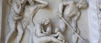
“Paradise exists, but no longer on earth”
Luca Giordano. Expulsion from Paradise
The heavenly bliss of the ancestors did not last long. After the Fall, the Lord expelled them from Eden “and placed in the east by the garden of Eden a cherub and a flaming sword that turned to guard the way to the tree of life” (Genesis 3:24). The expulsion from paradise was the beginning of a total change in all of nature. The earth became cursed and began to grow “thorns and thistles” (Gen. 3:17–18). We can say that paradise, as a place of union of the visible and invisible worlds, as a place of special residence of God, of communication between the Lord and man, from that moment ceased its earthly existence. Thus, the word “paradise” for Orthodox Christians has two meanings: metaphysical – as a place of blissful sojourn of the righteous in the Kingdom of Heaven and geographical, which no longer exists after the expulsion of Adam and Eve. So it turns out that heaven exists, but no longer on earth. And no matter how much a person searches for the former geographical location of paradise, no matter how much he is carried away by scientific interest, or even simple curiosity, this question will forever remain a mystery. And if we find ourselves on the site of the former Eden and even paradise, then we will not be able to recognize it in any way - it is no different from the surrounding territory.
It should also be taken into account that paradise existed on earth before the Flood. After the Flood, the earth's landscape changed significantly.
Following the war chariots of the Assyrians
The seven gates are also mentioned in a clay tablet kept in the Louvre. It describes the military campaign of the Assyrian king Sargon II against the ruler of Aratta. On the way to the Manakhan Valley, the king overcame seven mountains, passed through gorges, crossed mountain rivers and finally reached the Surikash area in the country of Mannev with his army. Then he went further north and arrived in the Aratta valley, the same place where the envoy of King Enmerkar also sought to go. Dr. Rowe used a satellite image of the area and this is what he found. In front of him stretched a valley, in the western part of which Lake Urmia was located, inaccessible mountains rose above the valley from the north and south, and in the east, between the mountain ranges, a narrow passage was clearly visible connecting the valley with the outside world. To the north of the valley, in an area with the ancient name Kush, the same one mentioned in the Bible, flows the Aras River, which after the capture of Persia by Muslims received the name Tikhon. To the southeast of the valley flows the Kizel-Uizon River. But how did the Persian Vizon become the biblical Pison? This is explained by the replacement of the sound “u” with the sound “f” when translating the ancient Iranian name into Hebrew. Also, the Persian name of the area Nokhdi changed to the Hebrew name of the land of Nod, which was located east of Eden. Adam's son Cain was banished there after the murder of his brother Abel.
Beyond the purview of science
Nevertheless, the question of the geographical location of Eden will inevitably arouse scientific interest. Archeology as a science will never be able to definitively answer this question; it is beyond its competence. Because the Bible, the only reliable source on this matter, is not a 100% document for science. After all, Holy Scripture is not a textbook of ancient history or geography. This is a Book about the providential acts of God in the destinies of humanity, about the fall and rise of man on the path of searching for the Lord, about the salvation of fallen humanity. And for science, this is a collection of religious and mythological texts. Although the scientific world recognizes that any mythology, “in particular Christian,” is built on certain historical principles, nevertheless science must provide facts that are sufficiently substantiated, proven, verified through experience and experiment. Of course, there are scientists who, if only given free rein, will try to subject the Divine nature itself to an experiment. They are not convinced that the very first such experiment - the Tower of Babel - was not allowed to be completed by the Lord Himself. And, thank God, any such experiment is inevitably doomed to failure. “Do not tempt the Lord your God” (Deut. 6:16). Translated from Hebrew, Edem (Gan eden) means “garden of delights.” According to another version - “bliss”. Of course, this word can be interpreted in different ways. But the meaning is that it means a blissful state of spirit - the special presence of God, synergy, interaction of Divine and human nature. Therefore, the words paradise, We are going in any meaning: biblical, liturgical, paradise on earth, or the Kingdom of God, or the blissful, paradise state of the spirit of the righteous already in this earthly life, are beyond the scope of science. For us Christians, as well as for Jews, what is important is not the geographical location of Eden, but the fact that paradise is a special place of God’s grace. Therefore, it makes sense to think about the geographical location of paradise only for the sake of interest in general world knowledge.
What is Paradise?
In Islam, Paradise is called the word "Jannat", which translated from Arabic means "gardens": Islamic eschatology represents Paradise as gardens, where after the Day of Judgment, which is designated by the term "qiyamat", the righteous will spend their eternal life in bliss. Paradise in Islam is also denoted by such terms as “an-na'im”, which means “grace” in Russian translation, and the term “al-firdaus”. Paradise in Islam is huge, its dimensions are unimaginable and, as described in the Koran, are the width of all heavens and earth; the hadiths of the Prophet ﷺ report the large size of palaces and heavenly dwellings.
The Holy Quran says that the eternal or last life of a person is a continuation of his life in the earthly world: a person ends up after death and the Day of Judgment either in Paradise, which is an abode of prosperity and peace, or in, an abode of punishment and torment.
The main thing that a Muslim needs to know about this is that the last life is completely different from the earthly life, but fully reflects everything that was accomplished by man in his earthly life.
What is Heaven like in the minds of Muslims, who build their perception in accordance with how the Holy Book of the Lord describes Paradise? The Koran contains expressive and colorful descriptions of life in Paradise, but any description of Paradise can only be called general strokes, since the human imagination is not able to imagine the whole truth about the greatness of Paradise.
The Koran mentions four gardens of Eden and rivers flowing through them. Based on the data in the Koran, the righteous will find heavenly drinks and dishes for themselves in Paradise, it will be cool and calm there, they will be dressed in luxurious clothes, for them in Paradise there will be both their own wives and heavenly maidens as wives, and they will stay forever young. Children will not be born in Paradise, although marriages will be allowed and married life will take place. It is also mentioned that the angels of the Lord guard Paradise, and according to one version they are led by an angel named Ridvan.
According to Ibn Abbas, everything that is in the earthly world is also in Paradise, only it is called differently there, and God used some benefits in order to arouse interest in other benefits among humanity, and also with the help of some torments God warned sinners against other torments. In the same way, the actions and actions of a person that he takes in the earthly world are reflected in the afterlife, the eternal world, since for each of his actions or deeds a person receives reward: “ Whoever does evil will receive retribution for it ,” as it is said in The Holy Book of the Koran in Surah “Women”.
For a Muslim believer, the choice of life path is obvious: throughout their lives, the righteous reflect on how to get to Paradise after death, and try to live in accordance with this goal. Islam takes a clear position that eternal life, which awaits a person after death, no matter where he ends up, in Heaven or Hell, will also correspond to how he lived in the earthly world.
In Islam there is no such thing as purgatory, “good slaves” will go to Paradise, whose hearts are free and pure from hypocrisy and unbelief, arrogance and envy, lies and malice, but some sinful Muslims will go to Hell, after redemption they will be taken out of there and go to to Paradise.
“It is in vain to think about what happened at the creation of the world”
Thomas Cole. Garden of Eden
So, heaven on earth is a topic of biblical archeology, which still cannot answer the most important question: where was it? The book of Genesis, as noted above, speaks of four rivers into which the river coming out of Eden was divided. Two of them are the Tigris and Euphrates. But there are different versions about the rivers Pison and Gihon. For example, Gihon. This may be the Kidron stream, which originates from the spring of Gion in Jerusalem, known as the Spring of the Virgin Mary. There is also a hypothesis that Gihon is the Nile. There is an assumption that Fison and Gihon are the Aragva and Kura rivers in the Caucasus. There are even guesses that Pison is the Araks River. However, there is also a bolder geographical version, allegedly Pison and Gihon are... Indus and Ganges! This turns out to be a very wide location - from Mesopotamia to the Caucasus and even Hindustan. True, there is a more plausible hypothesis, according to which we are talking not about four, but about two rivers with their tributaries. Moreover, in ancient times in the east, the beginning was considered not the source, but the river delta. The Tigris and Euphrates merge to form one river – the Shatt al-Arab. And indeed one river upstream is divided into four... But even in post-Flood times, the Tigris and Euphrates, without merging, flowed directly into the Persian Gulf. The confluence formed later, as a result of the retreat of the waters of the Persian Gulf. Who knows which is more reliable? Nothing is impossible for God. The earth's landscape is constantly changing, and river courses are shifting. For example, if we travel along the left bank of the Dnieper, then along its entire length we will see many small reservoirs, oxbow lakes, lakes, and all this is the former bed of the Dnieper. But in Genesis we are talking about antediluvian (in the literal sense) geography. And after the flood, the rivers themselves could disappear - it was a universal cataclysm. Moreover, after the flood, the earth’s landscape could also change. The earth's crust only seems to be something stable. In fact, it is not static, but constantly moving. If you compare the modern appearance of the squares of ancient cities with their images on the canvases of artists of the 17th–18th centuries, it is easy to see how much they have changed, even if they were encased in paving stones and slabs. Therefore, the probability of “geographically going to heaven” is quite low. And it is in vain to think about what happened at the creation of the world and what has survived to this day. Only one thing can be said: most likely, Eden was somewhere in Mesopotamia.
Science and religion
To what extent do the events described in the Bible correspond to real historical events? We will not dwell in detail on the latest archaeological finds that confirm the theory that man is a product of evolution, and humanity arose in the Neolithic era. The important thing is that archeology dealt a serious blow to the biblical interpretation of the emergence of human civilization. Many began to consider the biblical story of the Garden of Eden a myth. But science is impartial, and the same archeology often presents surprises to scientists, destroying established opinions. The Book of Genesis contains facts confirming the reality of the Garden of Eden. So let's figure out whether he really existed.
Questionable authenticity
The point of biblical archeology is to find reliable confirmation of what is said in the Holy Scriptures or the history of the Church. It is possible to clarify something, to exclude a false version. Of course, this is important: church scientific activity must be on a par with modern secular science. But even the most grandiose ecclesiastical and archaeological discoveries cannot by themselves either add or subtract from faith. We believe not because we find reasoned evidence. Much the same can be said about miracles. If a person is not able to believe, then even such miracles as the resurrection of the dead or the sight of those born blind will never make a person believe in God. And on the contrary, neither the refuted authenticity of a biblical archaeological find, nor a “miracle” that turned out to be a simple trick of some rogue (alas, this also happens) can shake the faith of an Orthodox Christian. It's no secret that the reliability of many church and archaeological relics or places associated with sacred events is, to put it mildly, very conditional. For example, in Jericho, at least three trees “claim” that it was the tree that the publican Zacchaeus climbed. At least two places represent the site of the Ascension of the Lord. In ancient times, the inhabitants of Ephesus categorically refused to recognize Jerusalem as the place of the Dormition of the Blessed Virgin Mary - they were firmly convinced that this place could only be Ephesus. And such famous shrines as the Chiton of Christ in Trier or even the Shroud of Turin also do not have indisputable evidence. Or, for example, the place of the Transfiguration of the Lord. The Gospel only says that the Lord ascended a high mountain. But it is not specified which one exactly. Until the 4th century, the prevailing opinion in the Church was that this was the Mount of Olives. But after St. Elena built a monastery on Tabor, and the opinion was established that the Transfiguration of the Lord took place there. Although many researchers dispute the possibility of this. Scientists agree that this was one of the spurs of Mount Hermon. Whether this is true or not is not important for us today. At least, no one today can know the exact location of the Transfiguration. After all, Favor is not a separate hill, but a mountain range. But there are guides who are ready to show gullible pilgrims supposedly “this is the place.” And the pilgrims then return home “with pockets full of happiness”: “And I was honored to visit the site of the Transfiguration of the Lord!”
"Every Christian should be a little 'atheist'"
Such joy, at some level of spiritual development, can be an assistant in faith. But faith must be strengthened along with the strengthening of the virtue of sobriety. Paradoxical as it may seem, for the first time in history Christians began to be called atheists. This nickname was given to the ancient Christians by the Roman pagans, since Christians denied faith in theos - pagan gods. And this is perhaps symptomatic. Christians must develop healthy critical thinking. Otherwise, faith easily turns into naive and stupid gullibility, about which St. Apostle Paul: “But turn away from worthless and women’s fables...” (1 Tim. 4:7). The Lord, perhaps, will forgive us more easily for some caution and even distrust than for gullibility and greed for sensations. If a person is looking for miracles, this does not mean that he is looking for God. This is exactly what the Lord warns about in a very harsh form: “An evil and adulterous generation seeks a sign; and no sign will be given to him” (Matthew 12:39). When a person is focused on searching for a miracle and, in particular, those artifacts that should somehow confirm the truth of his beliefs, then he can easily come to a state that in Orthodoxy is called “prelest.” And there are such people in every temple and in every pilgrimage group.
“Gospel love is already heaven”
We seek, first of all, God's righteousness, the Kingdom of God - “For behold, the kingdom of God is within you” (Luke 17:20-21). Serving God in people is the path to the lost paradise. This will help to see that every person is a spark of Divinity, which awakens not earthly, but Christian love. And Christian love has a heavenly system of relationships. It is precisely love in the gospel understanding that is already heaven. Where there is love, there is the Kingdom of God on earth. That’s where paradise exists, regardless of geographical location – from the Arctic to Antarctica.
Interviewed by Marina Bogdanova